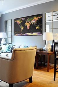
Primarily an artistic map, this topographical world map also includes basic information and labels for general reference.

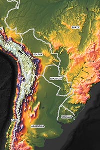
The highlight of this map is clearly the bold colors used to represent the worlds topography. Colors were selected to not only create an intuitive guide to the relative high and low elevation lands of the planet, but to create a striking color palette that looks great in the map.
Green represents low areas, typically the various coastal plains of the world. The most prominent low lying areas are the plains across Russia and Northern Europe, the Amazon River Valley in South America, the Southeast United States, and other coastal plains throughout the world.
Mid-level elevation is colored with yellows, orange, and red. This typically includes higher plains and grasslands. Much of Africa falls in this mid-level elevation range, as well as other high plains in other continents.
The highest elevation of the world is shown in colors blue, purple, and white. These colors are reserved for the highest mountains, such as the Himalayas in South Central Asia, the Andes that run through South America, and various other peaks in other continents. Many lands of Greenland and Antarctica are also at very high elevation levels.

Quite simply, this map looks amazing.
The bright colors, combined with the dark oceans and seas, combined with the bold Three Dimensional shading all help to create a world map quite unlike any other.
Since the map includes basic geographic reference (names of countries, mostly) it is also well suited for basic geographic reference.
But the real value of the map lies in its gorgeous artistic style that is bound to attract attention and curiosity no matter where it is displayed.