Note: To keep an uncluttered and artistic style of North Carolina's landscape, minimal text labels are included.

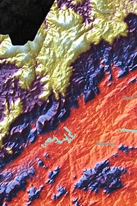
Low elevation in the map is represented by the color green. This includes the entire coastal plain along North Carolina's eastern coast, and also includes many of North Carolina's population centers, such as Raleigh-Durham and Fayetteville.
Middle elevation lands are colored in warm colors (yellow, orange, and red). This includes most of central North Carolina and the Piedmont at the base of the Appalachians. Major cities like Charlotte, Winston-Salem, and Greensboro are located in this mid-level elevation range.
High elevation is shown in blue and purple, with White being reserved for only North Carolina's highest peaks. Obviously, the highest parts of North Carolina exist in the western part of the state in the Appalachian range. North Carolina's highest point is Mount Mitchell at 6684 ft or 2037 m.
Learn how this North Carolina topographic image was created with digital elevation data.
The most obvious physical feature shown is the Appalachian Mountain range. Sub-level ranges are also visible: Blue Ridge Mountains and the Great Smoky Mountains.
The map also shows many of North Carolina's lakes and reservoirs. Jordan Lake, Hyco Reservoir, High Rock Lake, Badin Lake, Lake Norman, Lake Hickory, Lake James, and Hiwassee Lake are all shown.
The ocean floor of the Atlantic Ocean is also shown, as the floor shelf drops off just off North Carolina's coast.
84 North Carolina cities and towns are labeled.
All major cities like Charlotte, Raleigh, Greensboro, Winston-Salem, Durham, Fayetteville, and Asheville are shown.
Some of the labeled medium and smaller towns include Jacksonville, High Point, Goldsboro, New Bern, Statesville, Shelby, Lenoir, Laurinburg, Graham, Tarboro, Burlington, Hickory, Mooresville, Thomasville, Holly Springs, Havelock, Morrisville, Roanoke Rapids, Reidsville, Mount Holly, Pinehurst, Spring Lake, Knightdale, Mount Airy, Belmont, and many others.

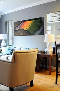
This North Carolina map is much more than a map: it's a stylish piece of art that will add color and décor to any room. The map will look splendid in your home, office, or will make an interesting addition to any classroom and be sure to get students excited about North Carolina geography.
Perhaps no map has ever been able to bring out the beauty of the North Carolina physical terrain as this map, and it would make a stellar addition to your room, sure to captivate viewers for years to come.