Virginia Physical Topography Wall Map


(Click images to see full-size)
Note: This map is an artistic representation of Virginia's terrain. Text labels are intentionally limited.
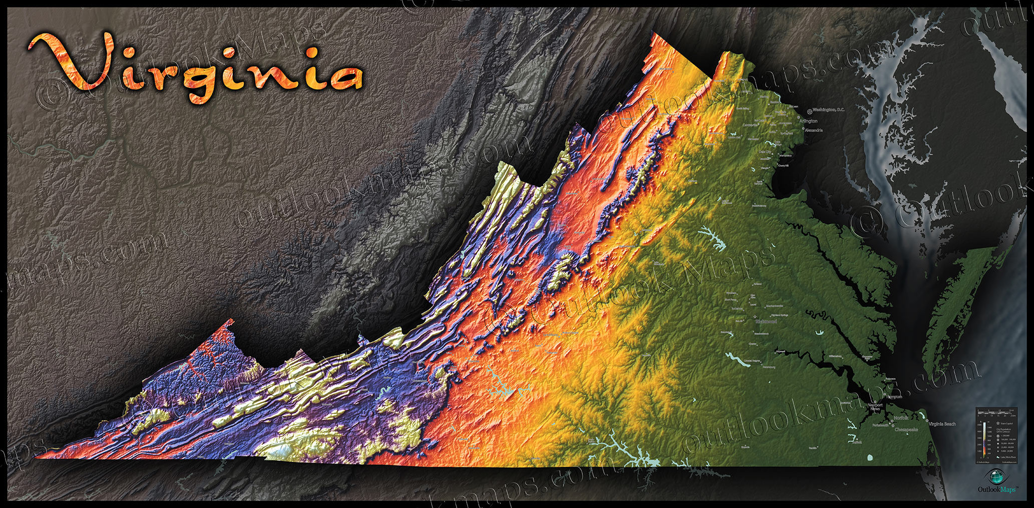
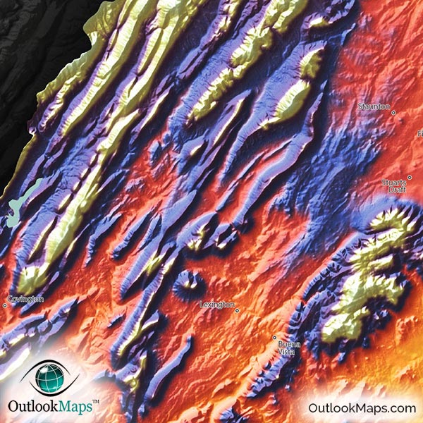
Virginia's low elevation land is colored green. This includes the Atlantic Coastal Plains in the east, the Piedmont area in central Virginia, and the Eastern Shore. Much of Virginia's population lives in this low-elevation region, including the three main population centers: Northern Virginia near Washington D.C., The Richmond area in , and the Hampton Roads in southeast Virginia.
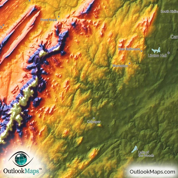
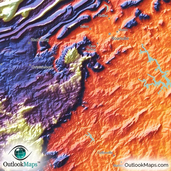
As elevation increases, land colors change to warm colors of yellow, orange, and red. This mid-elevation primarily exists in central Virginia, at the base of the Appalachian Mountains and the valleys within them.
High elevation is shown with blue and purple, while the highest peaks are colored white. Virginia's high elevation land is all in western Virginia in the Appalachian mountains. Virginia's highest point is Mount Rogers with an elevation of 5,729 ft / 1746 m. Mt. Rogers is located close to the point where North Carolina, Tennessee, and Virginia meet in southwest Virginia.
Learn how this Virginia topographic image was created with digital elevation data.
Most of the prominent physical features in Virginia are within the Appalachian Mountains, including the Blue Ridge Mountains, Allegheny Mountains, Shenandoah Mountains, and Cumberland Mountain. All of these ranges can be clearly seen in the map.
Many of the valleys carved out by rivers as they flow eastward toward the Chesapeake Bay and Atlantic Ocean can also be seen, such as the Potomac, Rappahannock, Appomattox, and Roanoke.
Virginia's lakes and reservoirs are also shown in this physical map, including John H. Kerr Reservoir, Lake Anna, Smith Mountain Lake, and many others.
105 Virginia cities and towns are labeled on the map.
Major cities like Washington D.C., Richmond, Arlington, Harrisonburg, Virginia Beach, Norfolk, Alexandria, Portsmouth, Charlottesville, and Winchester are all shown.
Some of the labeled medium and smaller towns include Fairfax, Front Royal, Warrenton, Wytheville, Bedford, Emporia, Dale City, Tuckahoe, Blacksburg, Annandale, Marumsco, Springfield, Sterling, Fredericksburg, Waynesboro, Meadowbrook, Laurel, Cherry Hill, Hollins, Poquoson, Wyndham, Forest, South Boston, Smithfield, Fishersville, Lake of the Woods, Buena Vista, Bridgewater, Bluefield, as well as many others.

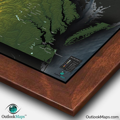
Unlike any other Virginia map, this topographic map has been designed specifically to look amazing on display. Bright colors, bold shading of mountains, and a sleek style all ensure that this Virginia map will attract attention and inspire curiosity from viewers.
Whether you're planning to display the map in your home, office, or classroom, you can rest assured that this map will stand out on any wall and add some spice to the decor of any room, all while creating a stunning image of Virginia's natural beauty.


